For centuries, the Amazon rainforest has been imagined as an immense green wilderness—remote, hostile, and largely untouched by human hands. But beneath its dense canopy, archaeologists are uncovering evidence of a very different past.
A major LiDAR survey has revealed hundreds of geometric earthworks in southwestern Amazonia, including vast circles, squares, ditches, embankments and roads. Most were invisible from the ground and could not be clearly identified in conventional satellite photographs.
The discoveries suggest that a sophisticated precolonial society transformed a region covering approximately 183,000 square kilometres—an area larger than many modern countries.
Researchers call this society the Aquiry civilization, using an Indigenous name associated with the Acre River. At its height between AD 100 and 300, it may have supported between 1.25 million and three million people.
Nearly 400 structures found for the first time
In 2024, researchers flew over parts of the Brazilian states of Acre and Amazonas, firing laser pulses through small gaps in the forest canopy.
The technique, known as LiDAR, allowed the team to digitally remove the vegetation and examine the shape of the ground below.
Across ten flight lines covering 4,497 square kilometres, the researchers documented 432 earthworks. Only 36 were already known, leaving 396 structures revealed for the first time.
The scale of what remains hidden may be enormous. LiDAR detected five times as many earthworks as satellite imagery in some surveyed areas. Based on those results, the researchers estimate that the wider Aquiry landscape could contain between 24,000 and 30,000 structures.
That figure is not a direct count. It is an extrapolation based on the density of monuments recorded along the survey routes. Even so, it suggests that the known sites represent only a small fraction of the original landscape.
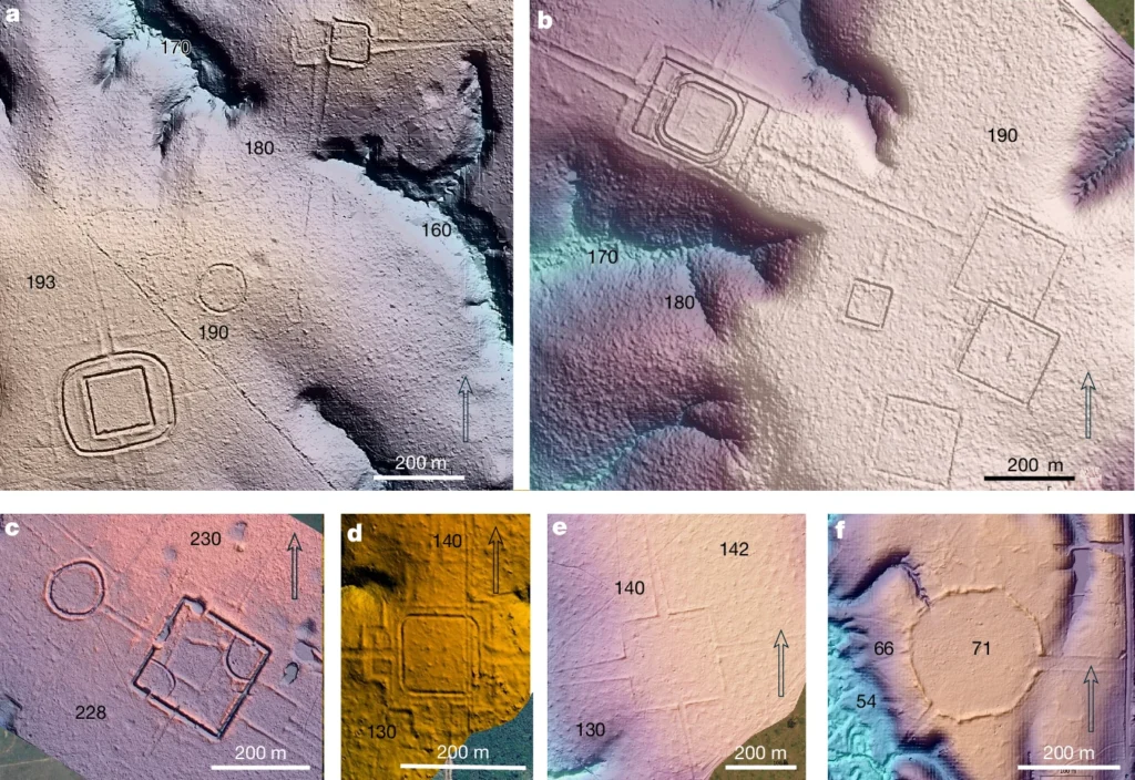
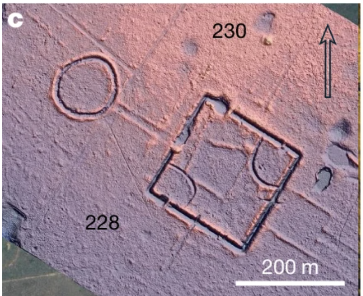
LiDAR-derived terrain models showing six examples of precolonial earthworks in southwestern Amazonia: Piloto, D. Schaan, Fazenda Atlântica and three newly documented sites. Shading and colour highlight the structures and surrounding landscape, while italic numbers indicate relative elevation in metres. Credit: Pärssinen et al., 2026.
Giant shapes cut into the rainforest
The earthworks were constructed between approximately 600 BC and AD 850. Many cover several hectares, while the largest known example approaches 50 hectares—roughly half a million square metres.
Some were surrounded by ditches measuring up to 13 metres wide and five metres deep. Others were connected by roads or grouped into monumental complexes containing as many as eight enclosures.
Yet these vast structures do not appear to have been fortresses.
Researchers found no clear evidence of defensive architecture or permanent settlement inside many of the enclosures. Instead, they believe the sites served as political, ceremonial and public gathering places.
People may have travelled from surrounding communities to attend rituals, celebrations, sporting events, dances or political meetings. The study compares this form of temporary gathering with practices later seen in parts of the Inca world.
Building these monuments would have required coordinated labour, planning and a detailed understanding of mathematics and geometry. Their repeated construction and maintenance over nearly 1,500 years points to a stable and highly organized society.
Was the Amazon once far more crowded?
The population estimate is among the study’s most provocative conclusions.
Researchers calculated that thousands of earthworks may have been active at the same time during the Aquiry civilization’s peak. They then compared the sites with later mound villages and Indigenous ceremonial gatherings, estimating that an average centre may have been maintained by a community of roughly 300 people.
This produced a regional population estimate of between 1.25 million and three million. In the most densely occupied core zone, as many as 32.6 people may have lived within each square kilometre.
The Aquiry region represents only a small portion of Greater Amazonia. If similarly dense settlement patterns are found elsewhere, existing estimates of the Amazon’s precolonial population may have to be dramatically revised.
A rainforest shaped by people
The inhabitants did not simply live beneath the trees. They cultivated maize, squash, manioc, sweet potatoes, beans, peanuts and chilli peppers. They also managed Brazil nut trees and edible palms, whose modern distribution may still reflect ancient planting.
Repeated burning of bamboo-rich areas may have helped maintain fertile soils, while forest gardens provided food across generations.
The “untouched” rainforest, in other words, may partly be a cultural landscape shaped by thousands of years of human activity.
The reason the Aquiry earthwork tradition ended around AD 850 remains unknown. But its traces survive—in the soil, in the vegetation, and in tens of thousands of monumental shapes still concealed beneath the trees.
Pärssinen, M., Kalliola, R., Ranzi, A. et al. Over 20,000 precolonial earthworks in the Southwest Amazonia. Nature (2026). https://doi.org/10.1038/s41586-026-10835-7